The Front Range Overnighter: Boulder to Ward and Back
Leave Boulder after work, sleep at 2,800 metres, be back before lunch. The climb is 25 km long and it does not let up, which is the entire point.
- gravel 48%
- paved 46%
- doubletrack 6%
Season: Late May to early October. The Peak to Peak corridor holds snow into May and the upper dirt stays greasy for weeks after.
Where: Colorado Front Range, United States
Why This One
Most people’s first bikepacking trip fails on logistics, not fitness. This route removes the logistics. You leave from a city, you climb one canyon, you sleep, and you come back down a different road.
There is no shuttle, no permit, no resupply strategy beyond a grocery stop, and no point where you are more than 20 km from pavement. If it goes wrong at any stage, the fix is to turn around and coast home.
What it does have is 1,540 m of climbing in 71 km and a summit at 2,860 m, which is enough to teach you everything you got wrong about your setup. Most riders pack differently the second time.
Day One: Up Left Hand
The route leaves north Boulder and turns into the mouth of Left Hand Canyon at around km 8. From there it climbs for 25 km without any meaningful flat.
The lower canyon is paved and shaded, with Left Hand Creek beside the road for the first 10 km or so. This is where you fill up, because the upper canyon is dry and exposed and you will want more water than you think. Three litres out of the creek is the sensible carry.
The dirt starts partway up and the surface is graded county road, loose in the corners and washboarded on the outside of the turns. Loaded, the washboard is where you find out whether your seatpack is packed tight. A loose one will slap for the whole 6 km of it.
Ward appears at km 33 as a scatter of buildings at 2,860 m. There is a general store with limited and seasonal hours. Plan the trip as though it will be closed and treat it as a bonus if it is not.
The Night
From Ward the route joins the Peak to Peak corridor and drops onto forest land east of the highway. Dispersed camping is legal across most of this section of the Roosevelt National Forest, with the usual rules: camp 30 m from water, respect signed closures, and pack out everything.
Check fire restrictions before you leave. By August in a dry year a stove ban is common, and arriving at 2,800 m with a canister stove and no cold-soak plan is a bad evening.
It gets cold. Boulder can be 30°C when you leave and camp can be 3°C at 5 am, and that 27 degree swing is the single most underestimated thing about this route. It is the classic place to discover that a 5°C-rated quilt means 5°C on a still night and 9°C on a windy one.
Day Two: Down Lee Hill
The return drops back east, picks up Lee Hill Road, and descends to Boulder on pavement.
It is fast, it is steep in places, and it is genuinely the best part of the route. It is also where a loaded bike behaves differently from an unloaded one, so take the first two corners more slowly than you want to. A seatpack that felt fine climbing at 8 km/h has opinions at 60.
You are back in Boulder before lunch, which is the reason this route exists.
Before You Go
Water and fire conditions on this route change through the season and between years. Both of the creek sources listed above are seasonal, and the store hours in Ward are not something to build a plan around.
Check the current forest conditions, fire restrictions and closures before you leave, and carry the water you need rather than the water you hope to find. That is true of any route report, including this one.
Resupply and water
Checked against current conditions on August 3, 2026 . Seasonal sources and small-town opening hours change between years. Verify before you rely on any of them.
| km | Stop | Type | Notes |
|---|---|---|---|
| 0 | North Boulder | Water + food | Last full grocery. Fill everything here, including the bottle you were not going to carry. |
| 11 | Left Hand Canyon, lower | Water | Left Hand Creek runs alongside the road and is reliable through summer. Filter it. This is the last easy water for 20 km of climbing. |
| 21 | Jamestown | Bailout | Small mountain town roughly 5 km off route up James Canyon. Seasonal services, do not count on them. Useful as a bailout, not as a plan. |
| 33 | Ward | Water + food | General store at 2,860 m, hours are limited and change with the season. Treat anything you get here as a bonus and carry the day's food from Boulder. |
| 38 | Peak to Peak dispersed camping | Water | National forest land east of the highway. Creeks run through midsummer and can be dry by September. Verify before you commit to a dry camp. |
| 52 | Lee Hill Road summit | Bailout | From here it is downhill to Boulder on pavement the whole way. Any mechanical past this point is a coast, not a walk. |
Kit for this route
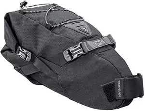
Topeak Backloader 15L
- • High capacity
- • Waterproof inner bag
- • Air release valve

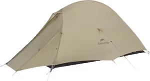
- • Genuine ultralight weight
- • Resilient 20D Nylon
- • Compact pack size
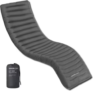
Trekology UL80 Inflatable Sleeping Pad
- • 4-inch thickness
- • Curved body baffles
- • Easy one-way valve
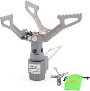
- • Incredibly light (25g)
- • Extremely affordable
- • Tiny pack size
iGPSPORT BSC300T GPS Computer
- • 20-hour battery life
- • Touchscreen navigation
- • ANT+ and BLE compatible
Frequently Asked Questions
Can you ride this on a gravel bike?
Where do you actually sleep?
How cold does it get at the top?
Is the climb really 25 km?
Ryan Cooper
Based in Colorado, Ryan is the guy who spends his Friday nights plotting questionable out-and-back routes. He focuses on practical, budget-conscious setups that work. He's learned the hard way that you don't need a $500 tent to sleep well in the woods.